Shop

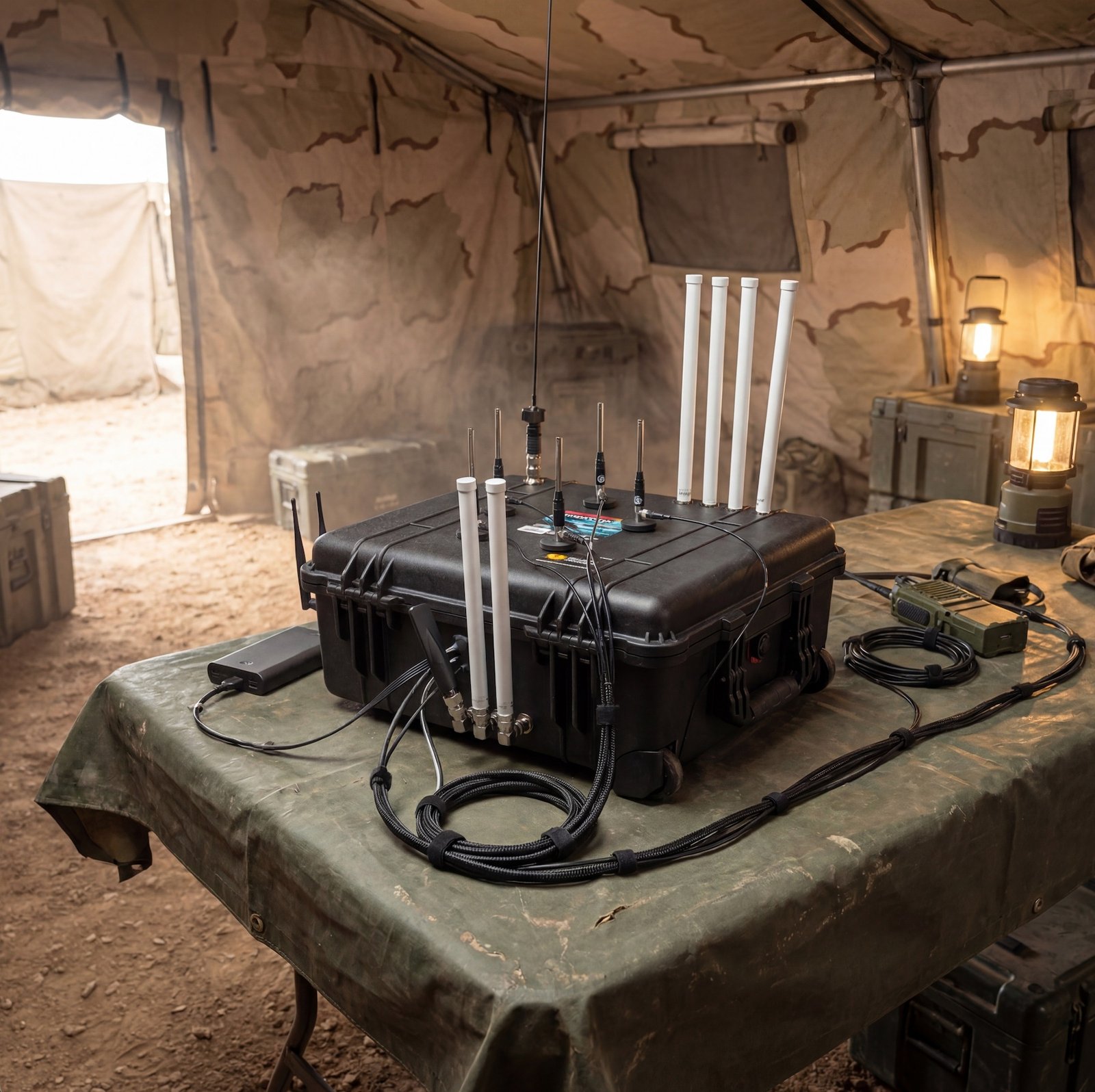
AtlasRF
Multi-sensor monitoring system. Tracks aircraft, vessels, drones, and ground vehicles on a single map. Full capability ships on every unit — configuration tailored to your mission.

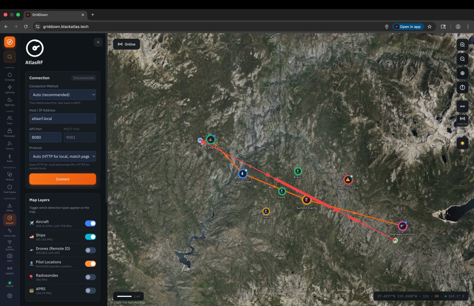
GridDown Tablet
Samsung Galaxy Tab Active5 Pro (cellular) with GridDown pre-installed and offline maps. Add sensor modules anytime.

GridDown Software
One-time purchase with free updates forever — no subscription. Android compatible, Linux support coming soon. Digital download — instant delivery.

Secure Messenger
Free GridDown Secure Messenger firmware for the T-Deck CYPHER M8K. Encrypted mesh communication — no cellular or internet required. Hardware via Rokland affiliate.

Sensor Hub
Plug-and-play situational awareness module. ADS-B, UAT, FAA Remote ID, and integrated 406 MHz SARSAT beacon receiver. Connects to GridDown over WiFi.

NDAA Component Database
138 verified NDAA-compliant UAS components across 19 categories. Filter by compliance status and country of origin.